Monthly Archives: February 2015

Yankee Springs – Winter Fat Bike Trail

6.5 miles – Winter Single Track – Yankee Springs Recreation Area

Highlights: Groomed snow at one of West Michigan’s most popular mountain bike trails.

Trailhead: The trail starts at the Deep Lake Unit at 2526 South Yankee Springs Road Middleville, MI.  Parking is just past the contact station on the right.  In the winter this will be the only thing that is plowed.  At the trailhead there is room for about 30 cars, 2 changing rooms, a pit toilet and an information board with a trail map.

A Michigan Recreation Passport or $9 day pass is required for non-resident vehicles.

Driving Directions >>

yankee-trailhead-parking

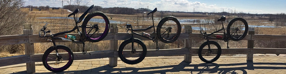
Yankee Springs Fat Bike Trail Parking

The Ride:  The Deep Lake Mountain Bike Trail, which is typically just called “Yankee” by locals was one of the first bike trails in West Michigan.  This is where a lot of us first learned to ride technical single track and it still remains a favorite.  In 2015 the West Michigan Mountain Biking Alliance obtained permission from the Michigan DNR to start grooming part of the trail for winter fat biking.  For the most part the winter trail follows to same track as in the summer other than a couple spots that are too tight to get the snowmobile through.  The groomed parts include the 2 mile warmup loop and then the 4.5 mile front loop of the main trail.

To pick up the warmup loop, saddle up on your fat bike and ride back past the contact station towards the road where you came in.  You will see the start of the trail on your left about 200 feet from the entrance.  Most of this loop runs through an area that had a controlled burn done a couple years ago.  It is still pretty open on the forest floor here, especially in the winter.  This shorter loop must not get as much traffic as the main trail and can be a little softer at times.  After 2 miles of pedaling the trail spits you out right back out in the parking area near the pit toilet.

GoPro video of the warmup loop in 150 speed.

To continue on to the main loop, go right to cross the road and you will see the trail heading down a slight hill.  You pass through on open area and then just after you get back into the trees you will cross a bridge over a small creek at about 0.6 miles into this loop.  Just before the bridge you will see the trail going up a hill to the left.  If you take this you will cut back to the trailhead for shorter 1.25 mile loop.  In the winter the bridge is used to get you across the creek in both directions.  You will be back here again at the end of the 4.5 mile main loop.

After climbing out of the creek valley the trail dips down into another little low section before you start ascending up on the ridge that runs on the west side of Deep Lake.  For about the next mile the trail twists along the top of this ridge.  Without the leaves on the trees you will have a view of Deep Lake for most of this section.  At about 1.8 miles the trail swings to the west.  You will ride through a horseshoe section of trail that is called “The Peninsula” where you can get a good idea of how far ahead, or behind, you are from your friends.  After this you will be in the toughest part of the winter loop as the trail slowly climbs up to the cut back at about 2.5 miles.  You will know that you are at the turn back point when you see the guard rails on the corner of Deep Lake Road.  This road is seasonal and in the winter there is only snowmobile traffic.  If you want to get in a couple extra miles you may be able to follow the packed snowmobile tracks to the north for about a mile up to Chief Noonday road.

yankee-guardrails

The guard rails at the corner.

To continue on the main loop take a left down a 0.2 mile perfectly straight section of trail that is shared with snowmobiles.  Watch for a post with both orange and brown arrows pointing you left toward Deep Lake.  For the next 0.75 miles you are rewarded for your climb with some slightly down sloping trail.  In the summer this is wide sandy section of trail is known as the “speed zone.”  It is not as fast, but it is still a fun in the snow.  After this the trail parallels Gun Lake Road and then cuts to left and back over the creek bridge you crossed near the beginning.  This is the only part that is a little hard to follow in the winter.  About 200 feet after the creek, the trail climbs up a hill after a sharp right.  This is the cut back that was described for the 1.25 mile loop above.  The last 0.6 miles has a few short climbs and then ends on the entrance road directly across from the start of the warm up loop.

yankee-fat-bike-trail-sign

The fat bike trail marker pointing back toward Deep Lake.

GoPro video of the first section of the main winter loop.

GoPro video of the second section of the main winter loop. (this video was on a different day)

Ride Map:
Yankee Springs Trail Map:

If this map does not show above, click here to download or print >>

Post Ride Beverage: For years we would go to Sam’s Joint to get something covered in their award winning barbecue sauce for lunch.  Unfortunately, the owner retired and it closed a couple years ago.  The best place to go now is probably the Terrace Grille at Bay Pointe Inn.  It is a little too fancy for me, but the food was very good.  Make sure to check their hours in the off-season.

In the Area:  The Deep Lake Unit is also home to one of the largest rustic campgrounds in Michigan.  Come back after the snow melts to spend a night and ride the rest of the 11 mile loop.  The first half of the back loop is some of my favorite single track in the area.

Links:


 Make sure to come back and Rate This Ride at the top of this page.


Facebooktwittergoogle_plusredditpinterestlinkedinmailby feather

Muskegon State Park – Fat Bike Beach Ride

13 miles – Sandy Beach – Muskegon State Park

Highlights: 2.5 miles of undeveloped Lake Michigan Beach.

Trailhead: This ride starts in the day-use beach area at Muskegon State Park. It is located on the south end of the park near the channel to Muskegon Lake.  There are 2 paved parking areas that each hold at least 200 vehicles.  Between the 2 lots you will find a beach house with restrooms and changing areas.

A Michigan Recreation Passport or $9 day pass is required for non-resident vehicles.

Driving Directions >>

The Ride:  At the start the beach is about 400 feet wide and you may have to push your fat bike down to the water depending on the time of the year. This ride goes out and back to the north. For about the first mile you will see the Scenic Drive running parallel to the shoreline just above you. There are a couple different spots where the road shoulder is wide enough to park cars and you will notice more people on the beach in these areas.  When the road swings inland you should start seeing less traffic.  This is also the beginning of the less developed and most scenic part of the ride.

At about 2 miles you come to the Lake Michigan Campground beach area. Muskegon State Park has 244 modern campsites split between here and the Channel Campground on Muskegon Lake. On a nice summer day you will encounter a big groups of campers spread out enjoying the beach here.

About a 0.3 miles past the campground you pass the northern border of the State Park and homes and cottages begin.  You will also start to see more wood break walls that were installed by property owners to control beach erosion.  Most were easy to navigate around or you can try and bunny hop the shorter ones.

At about 4 miles into the ride you will pass Pioneer County Park.  This 145 acre park is operated by Muskegon County and has just under a 0.5 mile of beach frontage.  According to their website they also offer: “modern camping, swimming, sunbathing, picnicking, tennis, softball, basketball and volleyball.”  This would probably be the best place of a pit stop along this ride if you need one.

After Pioneer Park the next 2.5 miles are smooth pedaling with few obstacles.  At 6.5 miles in there is a maze of break walls running both along shore and out into to the water.  I shouldered the bike and started walking around the first couple, but then it became apparent that to continue I would have to either walk in the water or trespass to get around.  The water was still in the 40s so I decided to make this the turnaround point.  Passage here will likely vary from year to year based on Lake levels and sand bars.

I had planned to continue on another 4 miles up to the White Lake Channel and see the White River Light Station.  If you do this ride please let us know in the comments below if you were able to make through this section.  

 Map:

Post Ride Beverage: There are only a couple options right by Muskegon State Park.  The Red Rooster Tavern is only 6 miles north on Scenic Drive so we thought we would give it a try.  It is a typical tavern atmosphere with okay pub food.  There was an interesting mix of people with everyone from families to bikers.  Most of the bikers were the kind that wear the leather chaps…if you are running these on your fat bike you are a true BA.

I did see that the Red Rooster has new owners since our last visit.  It sounds like they have updated both the interior and the menu.  We will have to check it out the next time we are in North Muskegon.  

The Bear Lake Tavern is the other option and is only 3 miles from the State Park. It looked nice when we drove past, but it has mixed reviews.

In the Area:  Muskegon State Park has 11 miles of hiking trails that are worth taking the time to explore.   We recommend the Dune Ridge Trail for a panoramic view of the harbor and the dunes leading out to Lake Michigan.  Muskegon State Park hiking guide and map >>

18-muskegon-state-park-pano

The view from the Dune Ridge Trail. (Click the image to see the full screen version)

Links:

Ride Photos:

muskegon-parking-area

The parking area and beach house at Muskegon State Park.

muskegon-beach-ride

Beach erosion breakwall.

breakwalls-north-muskegon

The barricades at the turn around point of the ride.

end-beach-ride-muskegon

Back to the Muskegon State Park Beach at the end of the Fat Bike ride.

A GoPro time-lapse video of the beach ride.

Make sure to come back and Rate This Ride at the top of this page.


Facebooktwittergoogle_plusredditpinterestlinkedinmailby feather

Warren Dunes State Park – Fat Bike Beach Ride

5.0
01

10 miles – Sand Beach – Warren Dunes State Park, MI

*Unfortunately the Michigan DNR is no longer allowing fat bikes on the beach in Warren Dunes State Park.  See the comment section below for the latest updates on this.

Highlights: 3 miles of undeveloped Lake Michigan beach – Dunes up to 260 feet tall – An armed security force.

Trailhead: This ride starts in the day-use beach area at Warren Dunes State Park.  This is one of the most popular Michigan State Parks with over 1 million visitors each summer.  To handle all this traffic there are 5 big paved parking areas and 3 restroom buildings.  In the middle building you will find a concession with food and souvenirs in season.

A Michigan Recreation Passport or $9 day pass is required for non-resident vehicles.  Directions >>

The Ride: Saddle up on your fat bike and try to blast through the soft sand out to the waterline.  I have heard that on a clear day you can see the Chicago skyline floating on horizon straight to the west.  Take a quick look and then hang a right and head up the beach.

The first 3 miles of this ride are in the State Park.  Looking inland you will see several dunes that tower 200 feet or more above the Lake.  When I was here the conditions were almost perfect with flat hard packed sand and calm wind.

Right after leaving the State Park you will come to a big painted concrete structure that I think is the base of an old water tower.  This marks Weko Beach Park . This 40 acre park is operated by the city of Bridgman and looks like it would be a nice place to spend a day on the shores of Lake Michigan. It has a new beach house with restrooms and a food concession stand. There is also a 70 site modern campground here.

The next 2 miles are along a more developed section of beach.  I was stopped several times by mostly nice cottage and homeowners to ask me more about the fat bike.  It may be a good idea to do this ride earlier in the morning if you are here in July or August.

At about the 5 mile mark you come to a barricade of big steel poles that run out into the water about 150 feet.  There is also a “Private Property” sign that lets you know that “THIS AREA IS PATROLLED BY AN ARMED SECURITY FORCE.”  This is the start of the Cook Nuclear Energy Plant property.  I think you could probably sneak your handle bars in between the poles, but I decided it would probably be best to turn around here.

If you are looking to put a few more miles on the fat tires, It looks like there is about another 10 miles of good beach riding to the south of Warren Dunes.  I have not done this section yet.  I decided to go to the north because it looks like it is all homes and cottages along this section.  On the maps it looks like you should be able to make all the way to the channel in New Buffalo, MI.

Map:

Post Ride Beverage: After the ride It would be nice to kick back on the beach with a cooler, but unfortunately there are alcohol restrictions at Warren Dunes from March 1 to September 30.  We were planning to visit Greenbush Brewing Company when we were here, but it didn’t work out.  If you live in the area and have a recommendation please let us know in the comments below.

In the Area: The T.K. Lawless Mountain Bike Trail is just over an hour away from Warren Dunes in Vandalia, MI.  It is a long drive, but this 10 miles of hard packed rolling and twisting single track that is worth the trip.  See more at: http://www.mymichigantrips.com/warren-dunes-state-park-2013.html#TKLawlessPark

Links:

Ride Photos:

warren-dunes-beach-store

The concession at Warren Dunes State Park

beach-ride-warren-dune-stat

Perfect sand for Fat Biking at Warren Dunes State Park

drift-wood-on-beach

Nearing the north end of Warren Dunes State Park

approaching-weko-beach

Approaching Weko Beach Park

fat-bike-weko-beach

The old Water Tower Base at Weko Beach? If someone knows what this is please let us know in the comments below. Thanks.

beach-ride-end

The turnaround point at the nuclear power plant.


Make sure to come back and Rate This Ride at the top of this page.


Facebooktwittergoogle_plusredditpinterestlinkedinmailby feather